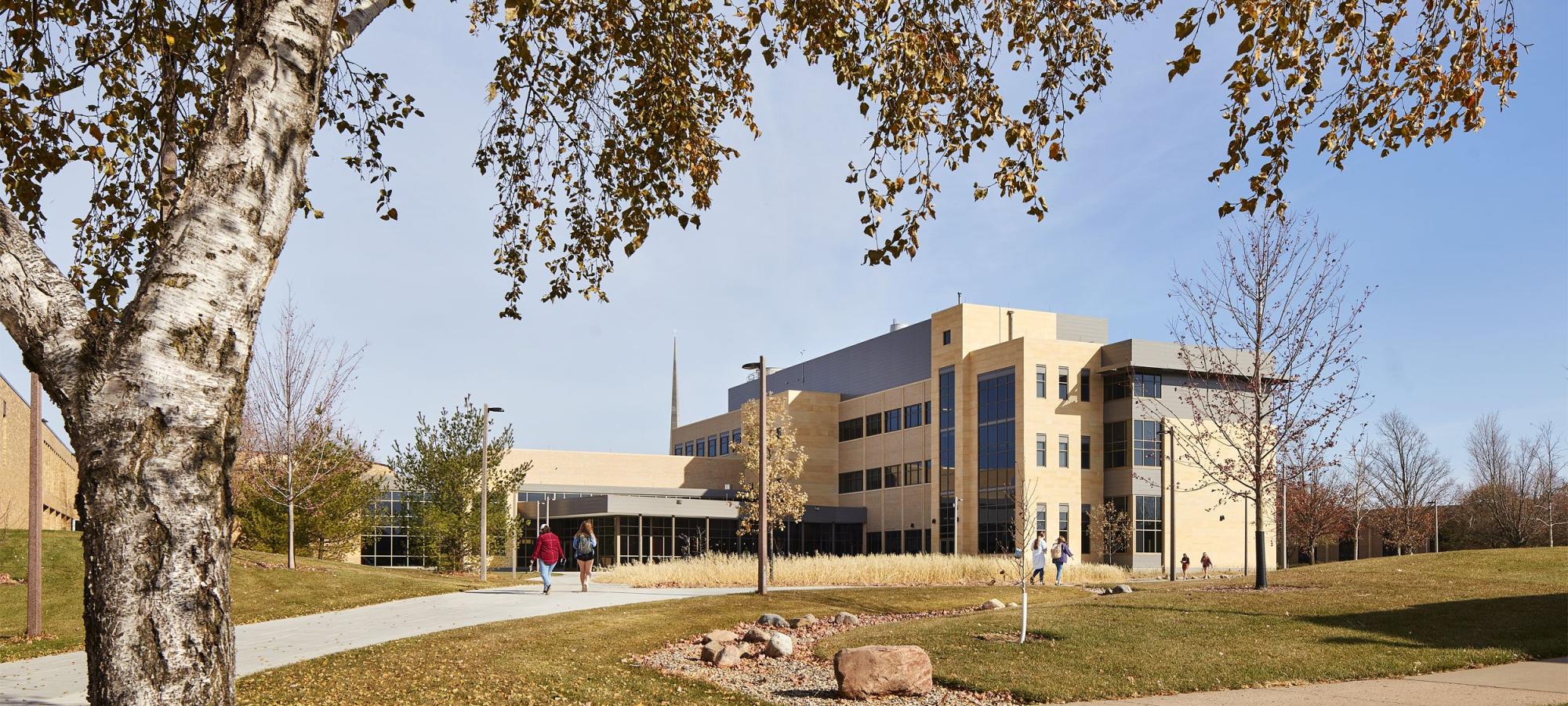
Lives Up to the Name
In 2021, our beloved Nobel Hall was flanked by fresh wings that doubled its size. Student and faculty input from all of campus guided its renovation and expansion. This building is not just for science majors. (Though it is admittedly pretty sweet for them.) At this world-class learning facility, everyone can do science. And in true Gustavus liberal arts fashion, the building is literally connected to our theatre and dance facilities.
Corpse Flowers
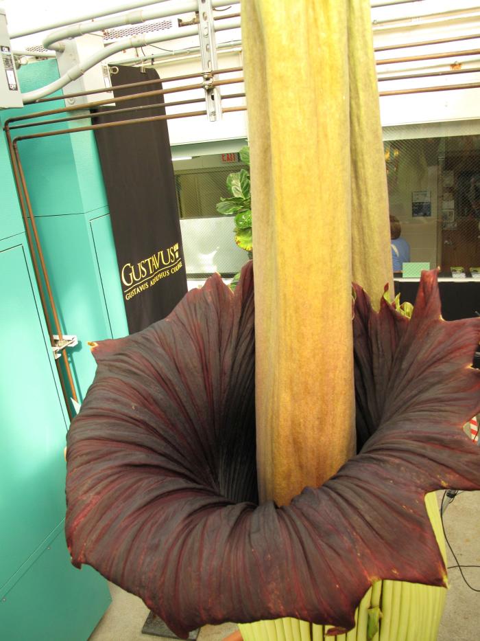
The corpse flower, also known to botanists as Amorphophallus titanum, is a rare flowering plant that is only found naturally in the tropical rainforests of Sumatra, Indonesia. With the largest unbranched inflorescence in the world, the corpse flower’s name comes from the repulsive scent it emits during the hours after it blooms.
- The corpse flower is located on the third floor greenhouse of the College’s Alfred Nobel Hall of Science.
- Visitors may visit the Nobel Hall of Science and view the corpse flower through the greenhouse windows every day from 8 a.m.–10 p.m.
- The greenhouse is located on the third floor of the Nobel Hall of Science
- Nobel Hall is #16 on this map, which also indicates parking locations. All lots are open in the summer for visitor parking.
- When the corpse flower is blooming, visitors will be able to smell the corpse flower from the hall outside the greenhouse windows. During blooms, the greenhouse may be open to visitors on a limited basis. Viewing opportunities will be posted.
- There is no cost to visit.
The oldest corpse flower at Gustavus Adolphus College is affectionately known as “Perry”. When Perry produced an inflorescence in May of 2007, more than 7,000 people came to see the rare plant, which was the first of its kind to bloom in the state of Minnesota. Since then, it continues to bloom every three to six years.
Perry came to the College when Professor of Chemistry Brian O’Brien received 20 seeds in 1993 from a San Francisco physician named James Symon. After years of careful cultivation, the plant finally bloomed for the first time in 2007.
Gemini I and Gemini II are from that same set of 20 seeds that Dr. O'Brien received in 1993, which have also started to bloom.
All corpse flowers at Gustavus are from that same set of 20 seeds.
What is the Latin name and what does it mean?
Amorphophallus titanum
Amorphos = without form, misshapen
phallos = penis
titanum = giant
What is it?
A tropical plant discovered in 1878 in Sumatra, Indonesia.
Is it the largest flower in the world?
No, actually it is the largest non-branched inflorescence. An inflorescence is a cluster of flowers—you may think of it as a bouquet. The plant that produces the largest single flower in the world is a member of the genus Rafflesia in the Euphorbiaceae family. Rafflesia arnoldii produces a single flower that is a meter (a little over one yard) wide. Rafflesia is also from the rainforests of tropical southeast Asia and Sumatra and Borneo in the Indonesian Archipelago. Like the titan arum, Rafflesia arnoldii is difficult to find and flowers rarely.
So if it is an inflorescence, then there must be a bunch of flowers—where are they?
The inflorescence of the titan arum is composed of two parts. The outer purple vase-like sheath is called the spathe. It protects the inner tube-like structure called the spadix, and its meat-like color serves to attract pollinators. The flowers are small and located on the spadix; there are hundreds of flowers hidden beneath the spathe.
If there are a bunch of flowers on the spadix, how come I don’t see a bunch of flower petals?
There are no petals on these flowers. Petals are advertising devices used by flowers to attract pollinators. Petals are especially important to plants like dandelions, lilies, and tulips to attract pollinators that depend on a visual stimulus to locate pollen and nectar in flowers. The titan arum uses another ploy to attract pollinators: it produces an odor that resembles that of rotting flesh. Flies and carrion beetles, in particular are attracted to the smell of rotting flesh, and many plants whose flowers produce such odors are fly-pollinated. The lower portion of the spadix is red and resembles rotting flesh.
What causes the foul smell?
The major components detected in the carrion and gaseous odors are the sulfur-containing compounds dimethyl disulfide and dimethyl trisulfide.
Why is this flower so big?
In the dense jungles of Sumatra a small inflorescence that relies on aroma to attract pollinators would have a difficult time spreading that aroma and attracting pollinators. The bigger the inflorescence the more successful it will be in spreading the aroma and thereby attracting pollinators. A brilliant strategy for a stationary plant! Even better is that the plant actually uses energy reserves to warm itself up to temperatures comparable to human body temperature. The warmth allows the compounds in the odor to volatilize more easily. So in other words, the warmer the titan arum gets, the stinkier it gets. (Think about the aroma of fresh baked bread. It is especially fragrant when it is hot out of the oven.)
What pollinates the titan arum?
Folklore speaks of elephants pollinating the titan arum, but we know now that it is much smaller organisms—flies, carrion beetles, and sweat bees. It is not known with certainty what pollinates the titan arum, but it has been observed that sweat bees are likely pollinators.
How is this inflorescence pollinated?
Here is another wonderful adaptation of the titan arum. The female flowers are on the bottom of the spadix and are red and open first. The male flowers are on the top of the spadix, opening later. Because the male and female flowers open at different times they do not pollinate themselves. Now here comes the cool part: Think about flies trapped inside a window. They tend to fly to the bottom and crawl to the top of the window. Pollinators fly to the lower portion of the spadix and then crawl upward. As they do so they pick up pollen and then fly off to a new titan arum starting at the bottom again where they cross fertilize a second titan arum with pollen from the first!
Why is it so rare?
Some plants like the titan arum are naturally rare. Lady’s-slippers in Minnesota would be examples of plants that are naturally rare. However the titan arum now faces two significant threats—collectors and, more critically, deforestation.
Where are the leaves?
The titan arum produces one leaf at a time for several years. The leaves start out small and get progressively larger. The leaf photosynthesizes and allows the plant to store energy in a large underground tuber. Each leaf lasts about a year before dying back and going dormant. Because flowering takes so much energy, it takes several years (10+ years) of just producing leaves and storing energy before the plant has enough reserves to produce a flower.
Who spreads the seeds?
The seeds are quite large (marble-sized) and are eaten and spread by tropical birds called hornbills. Attracted by the fleshy covering, the birds eat the seeds and excrete the inner seeds.
What is the “nickname” of this titan arum?
After discussion among students, staff, and faculty members, it was decided that it should be named after one of the Titans. This was somewhat problematic, since many of the Titans were not particularly good. This is Minnesota, after all, so “nice” is, for many, a desirable quality. We settled on “Hyperion,” the Titan associated with intellectual activity and observation, or “Perry” for short. Other gardens have nicknamed their titan arums too: “Baby” (Brooklyn Botanical Gardens), “Big Bucky” (University of Wisconsin, Madison), “Tiffy” and “Taffy” (Fullerton Arboretum), “Ted” and “Tabatha” (University of California-Davis Botanical Conservatory).
Do we have any plants like this that are native to Minnesota?
Yes, we do! The titan arum belongs to a plant family called the Araceae or the Aroids or Arum family. A relatively common Minnesota spring flower in this family is Jack-in-the-Pulpit, found in the St. Peter area as well as in other areas of Minnesota. It also has a spathe and spadix. Other plants in this family include calla lily, Anthuriums, Dieffenbachia (dumb cane, corn plant), and Philodendrons.
How long will the inflorescence last?
It will last only about 48 hours. It takes a lot of energy to heat up the flower, release the aroma, and attract pollinators.
Will it bloom again?
It will bloom when it has replenished the energy it exhausted blooming this time. In the meanwhile it will produce another leaf annually until it blooms.
What is the lifespan of titan arum?
Approximately 40 years.
How big can titan arums get?
The inflorescence can get up to 3 meters (10 feet) tall. The prize for the tallest arum goes to Amorphophallus gigas, which can be up to 4 meters (12 feet) tall (Gustavus, by the way, has a plant of Amorphophallus gigas in its greenhouse collection). Other species of arums can be remarkably small: Amorphophallus pusillus from Vietnam has an inflorescence that is just 3 cm tall.
How many species of arums are there?
More than 170, mostly in the tropics. Some of these species have odors that are more pleasant: carrot-like, anise, chocolate, banana, fruity, or lemon-like.
Why is it important to conserve these plants?
Many species in the genus Amorphophallus, including the titan arum, are highly endemic. This means that they are only found in relatively small, restricted geographic areas. If the rainforest home of these species is destroyed, we will lose these species.
Where else has this plant been grown and flowered before Gustavus?
In 2007, Perry was the first flowering of the corpse flower in Minnesota. It has been grown in major botanical gardens and greenhouses throughout the world. Before that, the most recent flowering event was at Kew, the world-renowned botanical garden in London.
What can I do to help conserve the corpse flower and similar plants?
Do not buy animals, birds, or plants that have been poached from forests. Join a conservation group. Learn more about tropical rainforests. Buy plantation lumber and not lumber harvested from rainforests. Support your local botanical gardens (Linnaeus Arboretum, Gustavus Adolphus College; Minnesota Landscape Arboretum, University of Minnesota).
Is it hard to grow?
It takes years of careful cultivation to grow, though it appears to be no more difficult to grow than other Amorphophallus species. Its growth cycle produces leaves, followed by periods of dormancy, until the underground structure, called a corm, has sufficient energy reserves to flower. In summer 2006, the Gustavus corpse flower was re-potted; the corm weighed 90 pounds.
What good is it?
First and foremost, a plant as magnificent as Amorphophallus helps us realize the incredible complexity and diversity of the natural world. It emphasizes the need to conserve plants and biodiversity. Species in this genus are used for food and medicine worldwide. The corm (tuber) and leaf stalks are boiled and eaten. The corms have been used to treat stomach ailments, fever, swelling, and diarrhea. Amorphophallus is toxic if not prepared properly as it contains calcium oxalate crystals. These crystals naturally deter animals from eating it.
EGE Spaces and Equipment
The Environment, Geography, and Earth Sciences Department houses instrumentation, equipment, and facilities that allow students to develop skill with modern tools for investigating the earth and environment. Both courses and research experiences use these tools regularly. Students and visitors can be trained on most instrumentation and equipment.
- Scanning electron microscope (Thermo-Fisher Prisma ESEM) with energy dispersive spectrometer (EDS) to investigate geological and biological specimens at very close range
- X-ray diffractometer (Rigaku MiniFlex 6G XRD) to determine chemical composition and crystal structure of minerals, rocks, and fossil specimens
- Inductively coupled plasma mass spectrometer (Agilent 7700x ICP-MS) for elemental analysis of water and solutions
- Large stream tables to conduct experiments about river processes and sedimentation patterns
- UV-visible spectrophotometers (Cary 50) to analyze elemental composition of water and solutions
- Ion chromatograph to analyze water composition
- Total organic carbon analyzer for high-precision measurement of carbon in rock and sediment
- GPS units to geolocate (Topcon Hiper SR sub-centimeter units, with Topcon FC-500 field controllers and licenses for Topcon’s Magnet Field and Magnet Office GPS processing software)
- Drone for aerial mapping and creating high-resolution digital surface models (DJI Phantom 4 Pro RTK, and DJI Phantom 4 Pro UAV, both with 20-megapixel cameras. Site license for Agisoft Metashape structure-from-motion image processing)
- Cathodoluminescence microscope to identify mineral phases, textures, and alteration in rocks
- Laser diffractometer with in-line imager to measure sediment grain sizes down to the sub-micron scale and take photos of particles (Microtrac S3500, SDC and SIA)
- Petrographic microscopes (Motic Panthera) to identify and describe minerals in rocks and sediments
- Rock crusher, rock saws (MK-Diamond 10 in tile saw, Covington 20 in slab saw, and 6-inch saw, rock grinder and polisher (Allied MetPrep 1) to prepare samples
- Muffle furnace to analyze samples and perform lithium borate fusions
- Ott MF Pro electromagnetic flow meter for estimation of stream discharge
- Geospatial Lab has 18 computers with geospatial software (e.g. ESRI ArcGIS) for in-depth analysis in courses and research
- Sedimentology and Geomorphology Lab
- Map room contains an archive of maps
- Environmental Studies projects room
- Student lounges
- Rock preparation and archive storage room
- Geospatial Lab
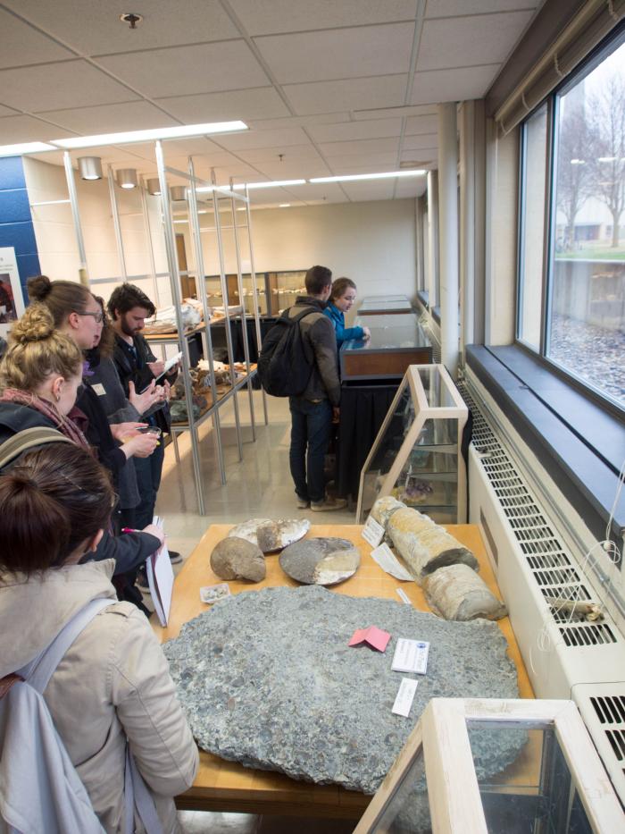
Explore the Earth at the Geology Museum. The Chester Johnson Geology Museum is home to numerous undergraduate student-made exhibits where visitors can explore natural history and geology through engaging with various displays housed in the museum.
For more information or to schedule a tour, send an e-mail to the g-geology-museum [at] gustavus.edu (geology museum)
The Chester Johnson Geology Museum is located in the lower level of Nobel Hall on the north side of the building in room 1300.
Visit
Visit the museum and talk with a geologist! Email the Geology Museum to find times when a student docent is working. Visit, bring a rock for identification, or ask questions about our exhibits! We look forward to welcoming you.
Museum Hours
Monday-Friday: 10 a.m.–4 p.m.
September–April when classes are in session.
Biology Facilities
These resources foster collaboration and provide hands-on exploration. The Biology Department maintains a variety of collections, including vertebrate, invertebrate, and plant collections as valuable resources for studying biodiversity, taxonomy, and anatomy. Plus, a campus greenhouse and Arboretum to explore plant physiology and ecology.
The Biology Department has two collections that focus on vertebrates offering the chance to engage in specimen-based learning, comparative studies, and research in the field of vertebrate biology.
- Gustavus Freshwater and Marine Fish Collection - This collection is dedicated to preserving and studying freshwater and marine fish species to assist in the study of fish anatomy and biodiversity.
- Gustavus Bird Collection - This collection comprises preserved bird specimens representing a variety of species. It serves as a valuable resource for studying avian diversity, anatomy, behavior, and ecology.
The Biology Department houses an extensive invertebrate collection that provides a valuable resource for studying insects to deepen an understanding of entomology and to conduct research projects related to insects.
- The Current Entomology Collection - Insect collections are an important resource for studies in taxonomy & natural history. Collections document species diversity, polyphenisms, and phenotypic differences between regions. Gustavus Adolphus College has an extensive insect collection, comprising thousands of insects from at least twelve different orders. Many of these insects are decades old—preserved from the 1950s and 60s.
- The Gustavus Adolphus College Insect Collection
The Biology Department has a digitized collection of plant specimens. The Plant Collection Families site is a resource to assist researchers and plant enthusiasts.
This two room facility is located in the basement of Nobel Hall and houses animals used in teaching and research laboratories. Typically mice, rats, and rabbits are used. The department also has a number of aquaria, freshwater and marine. Facilities and equipment are available for individual student research as arranged for with an instructor and/or animal room manager. Because of possible contamination with unknown or unwanted pathogens, wild or other animals are not allowed within the research animal section. The animal facility is registered with and inspected by the USDA (United States Department of Agriculture.) Any questions should be directed to Maureen Carlson. View information on the Institutional Animal Care and Use Committee.
The cell culture facility in Room 225 is used for student research and in immunology, cell biology, and cell culture classes.
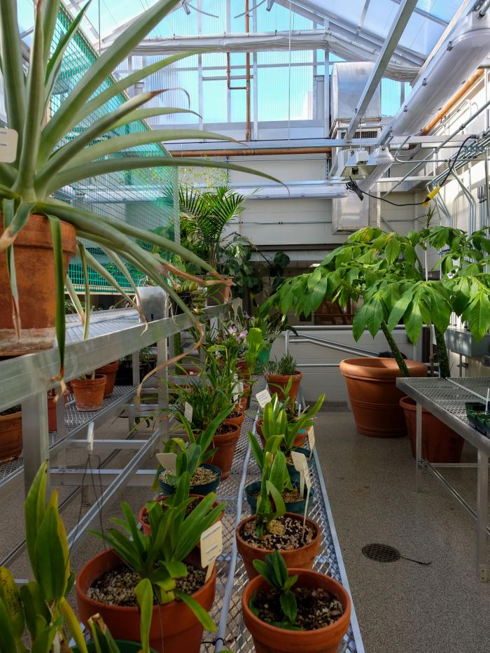
The greenhouse is housed in Nobel Hall and is used for student and faculty research, general biology, botany, and ecology laboratories. The greenhouse contains a variety of flowering plants, including cactus, other succulents, ferns, and tropical plants. Students are encouraged to explore the greenhouse. To learn more about select species found in the greenhouse, explore the links below:
Corpse Flower (Amorphophallus titanium)
Dwarf Banana Tree (Musa ‘Dwarf Orinoco’)
Pitcher Plant (Nepenthes sanguinea)
Staghorn Fern (Platycerium spp.)
This facility contains many plants from Sweden and Minnesota from as far back as the 1700's. Field botany students use the collection and prepare specimens to enlarge the holdings. The herbarium is located in Room 324A in Nobel Hall. Two of the collections found in the Gustavus Herbarium have been digitized. To explore these collections, use the links below.
- John Sandberg Plant Database
John Sandberg was a Swedish born botanist who collected extensively in the Northern Midwest and Rocky Mountains of North America during the 1880s. The Minnesota portion of his collection is housed here. Some other places where his collections are housed include: New York University, Harvard University, and the Smithsonian Museum. - Swedish Plant Collection
This collection contains many specimens collected in Sweden by Swedish and American collectors in the 1880s.
The Biology Department houses a licensed facility in Room 327 for the use of radioactive materials in lab courses and research projects. All students and faculty desiring to use radioactive compounds must take a videotaped radiation safety course. The tapes can be obtained from the institutional radiation safety officer.
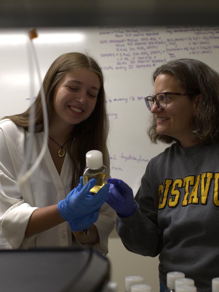
The Center is a three room facility that offers a range of capabilities. One room contains a Zeiss LSM 700 laser scanning confocal microscope, built using an inverted Zeiss Axio Observer stand augmented with a fully motorized stage and a second detector, a high-resolution CCD camera. The Center also has a fluorescence imaging room with a HORIBA Fluoromax-4 fluorescence spectrometer equipped with integrated cuvette stirring, brackets for supplemental filters, programmable temperature control, and rotatable filters for polarized light (i.e. to detect anisotropy). An accompanying computer suite contains six dual-monitor workstations with imaging and molecular modeling software, including two with stereographic viewing capability, plus both stereographic and high-definition image projection systems. These spaces are used for faculty-student collaborative research and for instructional purposes. The Center was equipped in part due to generous support from a Howard Hughes Medical Institute science education grant. The reservation calendar for the Center can be accessed by those with a Gustavus network username at Visualization and Imaging Center Calendar.
Note: If you get directed to a Google login page when using the link below, put your full Gustavus email address in the "Email" field and leave the "Password" field blank. When you click "Sign in" you will be directed to the Gustavus login page where you can log in using your Gustavus credentials.
Lab Kitchen and Wallenberg Auditorium
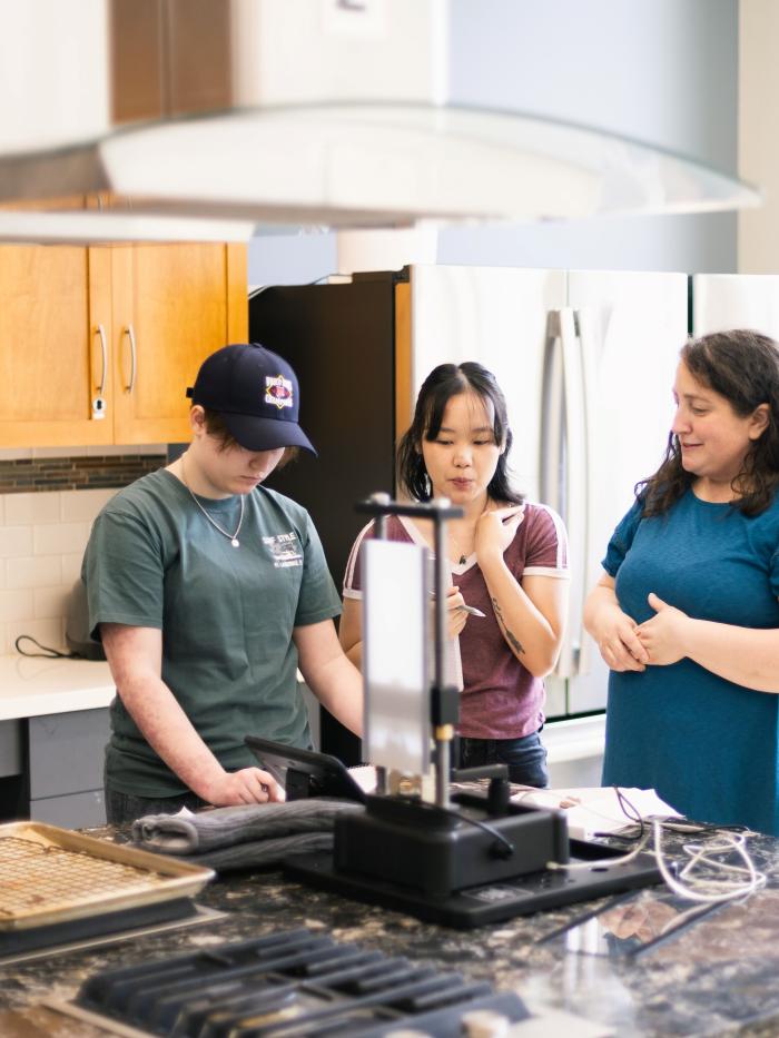
Food Science Lab Kitchen
Academic classes like the chemistry of cooking and the philosophy of food take place in the space as well as coffee breaks with the Chemistry club or bread and pizza making lessons through the Recreation Program.
Wallenberg Auditorium
This is a common place for public lectures and campus movies.
STEAMery
The STEAMery is located between Nobel Hall of Science and Anderson Theatre. This cafe offers freshly made breakfast and lunch options and grab-and-go specials include delicious soups, salads, sandwiches, smoothies, pastries and coffee beverages.